Directory
The Pekoe Trail Stage 03: Loolkandura To Tawalantenne
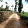
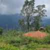
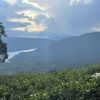
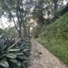
Length17.1 kmElevation gain687 mRoute typePoint to pointExperience this 17.1-km point-to-point trail near Tawalantenna CP, Nuwara Eliya. Generally considered a challenging route, it takes an average of 5 h 44 min to complete. This trail is great for backpacking, camping, and hiking, and it's unlikely you'll encounter many other people while exploring. PARTIAL CLOSURE: Please note that the last 4 kms (approx) from the campsite onwards have been temporarily re-routed to the end at Glenoch Tea Factory. Due to the recent adverse weather conditions the original route no longer meets the stringent safety standards of The Pekoe Trail. Restoration work is currently underway. The third stage of The Pekoe Trail begins at the small bridge over the Ma Oya on the Loolecondera Estate. During the first hour of the stage, there is some elevation gain with a challenging climb, especially the first bit. To start, it leaves the main road and takes the small road up to the right. A short distance later, there is a shed in front of a small school. The track leads to the right and soon there is a colorful Hindu Kovil and the Loolecondera Estate Bungalow below. Next up is a gentle climb on some of the prettiest and most historically significant tea trails in Sri Lanka. There is a trail heading down to the river below for those interested in seeing lovely rock pools or taking a dip. A gentle uphill zig-zag awaits, followed by the trails of the upper portions of the estate. There are fabulous views of the pine forest and the rock formations clearly visible to the right as it ascends. The further up the more remote it feels and the landscape feels strongly connected to the past. A sense of excitement and trepidation takes over as the path finds the jungle, leaving the last tea field of the Loolecondera Estate behind. The first portion of jungle consists of a small uphill track and then a right onto a much easier trail. This is the old and forgotten Dimbula Road, built by British engineers over 150 years ago to connect Kandy with the valleys beyond so that tea could be planted. This trail was meant for horses and bullock carts. Its historical purpose can be seen in still visible features like the perfect gradient, width, and stonework fittings. Solid 19th-century engineering was completely taken over by the jungle, lost in time. The path leads over the pass to the valleys on the Stellenberg Estate looking south across Kotmale and the Rilagala mountain range in the distance. On a clear day, Adam’s Peak is visible on the horizon. The estate roads of the Stellenberg Estate heading south are reasonably flat. With the Helbodde Tea Factory ahead, the route leaves a local village on the right hand side and continues south, over and around some of the most verdant tea bushes on the trail. There are not as many trees here as on the tea trails of the Loolecondera Estate, so sun protection is important here. Some distance later, the tea trail turns into a very poorly maint


