Directory
The Pekoe Trail Stage 20: Loonuwatte To Uda Pussellawa
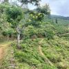
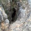
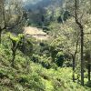
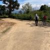
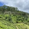
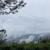
Length11.7 kmElevation gain604 mRoute typePoint to pointExperience this 11.7-km point-to-point trail near Ettampitiya, Badulla. Generally considered a challenging route, it takes an average of 3 h 49 min to complete. This trail is great for backpacking, hiking, and walking, and it's unlikely you'll encounter many other people while exploring.Stage 20 starts in Lunuwatte town heading west on a village road towards the Sri Wisuddharamaya Temple. Within a short distance, there is a pretty lake on the left hand side and the temple on the right. The trail continues straight down towards the paddy fields below. At the post, begin to ascent in between village homes. The next part is probably the hardest part of today’s walk as the track ascends zig-zagging up village roads until it enters the eucalyptus forest. Leave the village behind and from here on, all the way to the end, the trail is surrounded by forests, tea plantations, and stretches of quiet countryside – half uphill and half downhill. Continue to gradually ascend when entering the eucalyptus and pine forest. Don’t be intimidated by the mountain ahead, The Pekoe Trail circumvents the forested hill on the eastern side. The dominant plants on the hill are large eucalyptus trees apparently planted to stabilize the slope after the original forest was cleared some thirty years ago. Enjoy the wilderness and the views to the east as it follows the contour of the hill. The trail is thin but clear –a “category 1 trail“ at this stage. The trail arrives at the Sthripura Caves, an important cave network stepped in myth. Sthripura, also spelled Isthripura, is derived from Sanskrit and Sinhalese word Sthri which means woman, and Pura meaning town, and refers to a mythical incident where King Walagamba (who died in 77 BC) hid 500 queens in a cave to protect them (Basnayake, 1983). From here, head northwest on the clearly visible tea trail ahead. Leaving a small estate worker village to our left continue to walk on tea trails gradually ascending all the way to the top. Then the trail passes by the Estate’s Managers Bungalow. The route arrives the tea-trail junction, where it saddles both valleys and sits on the border between the Central and Uva provinces. Take the trail to the right and follow the trail on the ridge that is surrounded by pine forest. The views from here are stunning. Then descend through another eucalyptus forest and down the maze of tea trails. Look up ahead for the general direction of The Pekoe Trail – and the day ahead which is Uda Pussellawa to Ragala. After , having descended for a while, the trail goes uphill and then crosses a small bridge. From here the end of the stage is at the Uda Pussellawa town. The tea trail the route is on links with an old country road that heads down to the village. Hikers will see the main Uda Pussellawa-Ragala Road twisting and turning down below. It can be avoided by the secondary road that takes the route down into the center of town.The trail th


